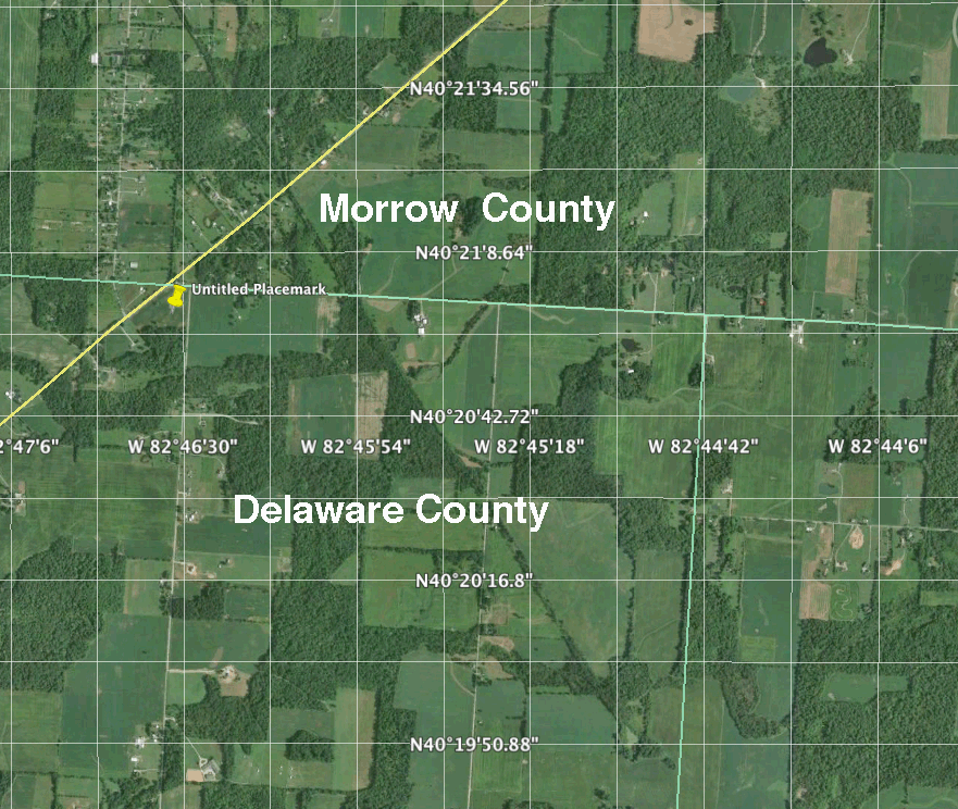
Google Earth Maps showing the approximate location of the
Dunham, Leach, and Kenney Lands.
The first photograph below shows the proximity of the property of the Dunham family to the Morrow County / Delaware County boundary line in Ohio. The green line on the map is the county boundary line.
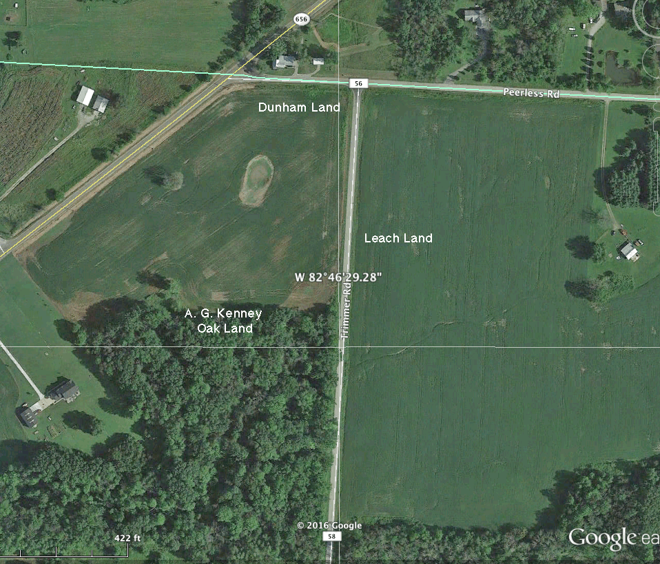
The thumbtack labeled Untitled Placemark is the location of the property of Elizabeth Dunham in 1866. The yellow diagonal line is SR 656. The map below this one is a closer view showing the approximate location of the land belonging to Elizabeth Dunham (#36), Harvey Leach (#17), and A G. Kenney (#19) in 1866.
Contact person for this website is Susan Snyder: susanleachsnyder@gmail.com