Ohio Country Map
1787 - 1803
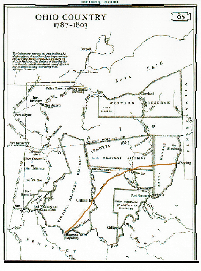
This map shows Ohio just prior to Gabriel Steely (#93)'s arrival. Note Zane's Trace (line in rust color) stretching from Wheeling, West Virginia, through Zanesville and Chillicothe, Ohio and on to Maysville, Kentucky. Zane's Trace (developed by Colonel Ebenezer Zane and his brothers) played a major role in the social and economic development of Ohio. Following the footpaths of Native Americans, this was the first road in the Northwest Territory. The road was opened in 1797. It was no doubt the road that Gabriel took around 1805 when he moved from Pennsylvania to a location not far from Chillicothe. A Zane's Trace memorial marker is located in the cemetery where Gabriel is buried: Mt. Pleasant Cemetery. For more information about Zane's Trace: Back in Time ... Zane's Trace
Contact person for this website is Susan Snyder: susanleachsnyder@gmail.com