1806 Map of Ohio
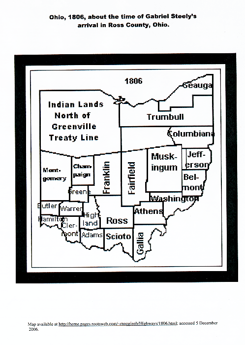
This map shows the counties of Ohio in 1806, just after Gabriel Steely bought land in Ohio. The location of Gabriel's property would have been in Ross County. Note: the Ohio River Survey of Congressional Lands identifies the property owned by Gabriel Steely as being in Pickaway Township in Pickaway County, Ohio. Pickaway County did exist until March 1, 1810. The General Assembly of Ohio, in session at Chillicothe on the 12th day of January, 1810, passed an act for erecting a part of the counties of Ross, Franklin and Fairfield into a separate county, by the name of Pickaway. The source of this information is History of Pickaway County. (Credit goes to Robert Steely for locating this map)
Contact person for this website is Susan Snyder: susanleachsnyder@gmail.com